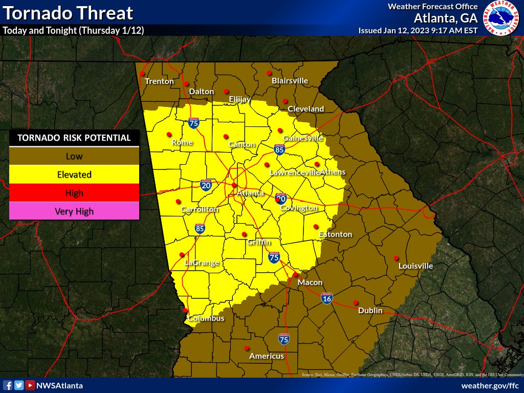
There remains an *Enhanced* risk (lvl 3 out of 5) for severe weather this afternoon and into the evening hours for much of north and central Georgia.
Threats:
Damaging Winds (>60mph)
Brief Tornadoes
Hail (up to 1″)
Timing:
NW GA: 12pm-4pm
I-85 Corridor: 3pm-8pm
SE GA: 7pm-11pm


A strong to severe line of storms associated with a strong cold front is expected to impact north and central Georgia Thursday afternooninto Thursday evening. The line is expected to reach extreme northwest Georgia as early as noon today and then reach metro Atlanta by mid afternoon, and then central Georgia in the late afternoon/early evening time frame. A wind advisory has also been issued from 11 AM – 11 PM EST to account for the elevated wind gusts (30-40 mph) ahead of the line that could bring down some trees and powerlines before the line makes it across Georgia.
Main Points
- A line of storms is expected to move through Thursday afternoon into the evening.
- This has led to the Storm Prediction Center (SPC) outlining portions of north and central GA in an Enhanced Risk (3 on a scale of 0-5) and portions of southeast central GA in a Sight Risk (2 on a scale of 0-5) .
- Those in north and central Georgia should be alert as everyone is likely to see impacts no matter what risk you are under.
- There is high confidence that north and central Georgia will see impacts related to the line of storms. The primary impacts expected are:
- Damaging wind gusts (up to 60 mph)
- potential to bring down trees and powerlines.
- Several, isolated tornadoes
- Frequent lightning
- Locally heavy rainfall
- potential to lead to localized flooding in low-lying areas or areas with poor drainage
- Damaging wind gusts (up to 60 mph)
- A Wind Advisory has been issued to account for high wind gusts, prior to the line of storms.
- Wind gusts of 30-40 mph are expected before the storms arrive
- Higher wind gusts could bring down trees and powerlines
- Wind gusts of 30-40 mph are expected before the storms arrive


